Contents
Index
Angles Mode
Entering a parcel defined by Angles from a Survey plan.
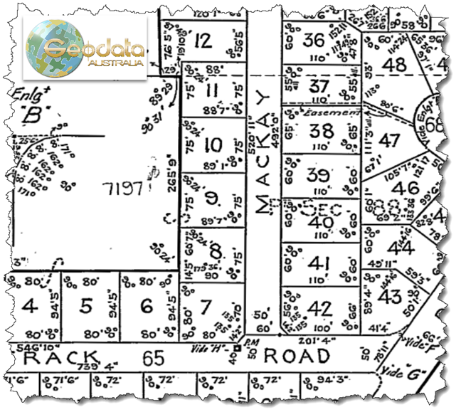
Many older plans may not use bearings and Distances to define parcels & angles between connected lines are used.
Note that using the Group feature for data entry is not available in Angles Mode,
This can be handled by GeoCadastre©.
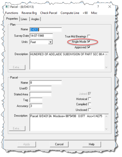
Select Angle Mode for Plan Properties
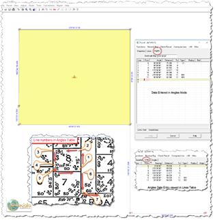
This does not allow access to the Lines Table as per normal data entry but after Angles and Distances
are entered as below and saved, the Lines Table is populated so that the parcel can be represented
by bearings and distances required for joining to the model and the adjustment.
Those Bearings and Distances only reflect the shape of the parcel from the plan angle and distance
measurements and the joining process overcomes azimuth issues.
See below.
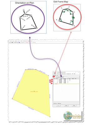
When entering a new parcel, the default back-sight is 180 degrees, and is filled out for you to
start entering the data.
You are always free to change it if you like.
The back-sight is the bearing from the start point of the parcel along the line to the first point
of the last line in the main parcel loop.
If you choose not to change the default back-sight, then in order to have the parcel approximately
oriented, it is recommended that you start with the most north-easterly point,
and proceed counter-clockwise around the lot, using positive angles for the internal angle values.
The angles data entry method is not conducive to adding connections outside the parcel,
however a connection traverse can be entered if it commences after the closing line of the parcel
is entered.
The operator needs to recognise that the process will use the previous line (closing line) as the
back-sight reference and enter the angle representing the change from that previous line to the
new connection line.
EXAMPLE
The Diagrams below show the hierarchy of angles and distances to complete data entry of the parcel
and 2 connections to get a cross road connection.